
- Joined
- Jan 3, 2009
- Messages
- 2,605
- Points
- 0
Carteret Atoll, also known as The Carteret Islands are part of Papua New Guinea located 86 kilometres northeast of Bougainville in the South Pacific at 4°45'S, 155°24'E. Carteret Atoll incorporates a scattering of low lying islands in a horseshoe shape stretching around 30 kilometers in north-south direction, with a total land area of 0.6 square kilometers and a maximum elevation of 1.5 meters above sea level.
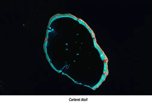
It was widely reported in November 2005 that the islands have progressively become uninhabitable, with an estimate of their total submersion by 2015. The islanders have fought for more than twenty years against the rising ocean, building sea walls and planting mangroves. However, storm surges and high tides continue to wash away homes, destroy vegetable gardens and contaminate fresh water supplies. On November 24, 2005, the Papua New Guinean government authorised the government funded total evaucation of the islands, 10 families at a time; the evacuation is expected to be complete by 2007. It has been estimated that by 2015, Carteret Atoll will be largely submerged and entirely uninhabitable.
Tuvalu, and Majuro are other small nations in the South Pacific which are likely to be evacuated in time to come.