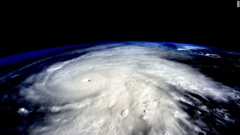
Storms etc collects moisture (vapor clouds rain) via heating up water from essentially oceans for the Giant Storms. More heat makes more moisture more heavy huge thick clouds, more high speed wind spinning with higher energy level, hence more lethal storms. When they hit, not only at more weight (of water) momentum, speed, more rainfall and flooding, more damages and deaths and hurt more people. Water and air are only medium to carry these energy from Sun in terms of heat. Essentially the energy will bring tremendous quantity of water from oceans, and throw it on our cities and farms and factories and roads and our shipping routes - more violently. Man fucked with planet earth, it will kill man in return.
https://earthobservatory.nasa.gov/Features/ClimateStorms/page2.php
NASA
Earth Observatory
Home
Images
Global Maps
Features
News & Notes
Storms are Getting Stronger
What exactly does it mean for storms to get “stronger”? Does it mean faster winds? A larger wind field? Lower pressure at the center? More rain and snowfall? Higher storm surges?
“You have to remember that storms aren’t one-dimensional,” says Del Genio. “There are many types of storms, and sorting out how aspects of each type respond to warming is where the science really gets interesting.”
sandy_sst_2012302
As Sandy was moving up the U.S. East Coast, unusually warm ocean temperatures allowed the storm to stay strong after it left tropical waters. (Map by Robert Simmon, using data from the NOAA Earth System Research Laboratory.)
Rising sea levels exacerbated Sandy’s storm surge, for example, a direct link between global warming and storm damage. And abnormally high sea surface temperatures in the Atlantic probably intensified the storm. But pinning all of Sandy’s fury—its hybrid nature, the scale of its winds, its unusual track—on global warming is premature, says Shepherd, the current president of the American Meteorological Society.
Weather forecasters use terms like snowstorms, derechos, hailstorms, rainstorms, blizzards, low-pressure systems, lightning storms, hurricanes, typhoons, nor‘easters, and twisters. Research meteorologists and climatologists have a simpler way of dividing up the world’s storms: thunderstorms, tropical cyclones, and extra-tropical cyclones. All are atmospheric disturbances that redistribute heat and produce some combination of clouds, precipitation, and wind.
Satellite image of the 3 fundamental types of storms.
Tropical cyclones, extra-tropical cyclones, and thunderstorms are the three fundamental types of storms studied by the climate change community. (Image ©2013 EUMETSAT.)
Thunderstorms are the smallest type, and they are often part of the larger storm systems (tropical and extra-tropical cyclones). All storms require moisture, energy, and certain wind conditions to develop, but the combination of ingredients varies depending on the type of storm and local meteorological conditions.
For example, thunderstorms form when a trigger—a cold front, converging near-surface winds, or rugged topography—destabilizes a mass of warm, humid air and causes it to rise. The air expands and cools as it ascends, increasing the humidity until the water vapor condenses into liquid droplets or ice crystals in precipitation-making clouds. The process of converting water vapor into liquid water or ice releases latent heat into the atmosphere. (If this doesn’t make sense, remember that the reverse—turning liquid water into water vapor by boiling it—requires heat).
Storms feed off of latent heat, which is why scientists think global warming is strengthening storms. Extra heat in the atmosphere or ocean nourishes storms; the more heat energy that goes in, the more vigorously a weather system can churn.
Diagram showing convection within a thunderstorm as it forms.
Thunderstorms derive their energy from the heat released by the condensation of water vapor. This “latent heat” energy drives thunderstorm clouds high into the atmosphere. Thunderstorms dissipate when the cold downdraft created by falling rain drops stifles rising warm air. (Image adapted from NOAA National Weather Service Life Cycle of a Thunderstorm.)
Already, there is evidence that the winds of some storms may be changing. A study based on more than two decades of satellite altimeter data (measuring sea surface height) showed that hurricanes intensify significantly faster now than they did 25 years ago. Specifically, researchers found that storms attain Category 3 wind speeds nearly nine hours faster than they did in the 1980s. Another satellite-based study found that global wind speeds had increased by an average of 5 percent over the past two decades.
There is also evidence that extra water vapor in the atmosphere is making storms wetter. During the past 25 years, satellites have measured a 4 percent rise in water vapor in the air column. In ground-based records, about 76 percent of weather stations in the United States have seen increases in extreme precipitation since 1948. One analysis found that extreme downpours are happening 30 percent more often. Another study found that the largest storms now produce 10 percent more precipitation.
Graph showing the global increase in humidity since 1970.
Increases in global temperature have raised atmospheric humidity. (Graph by Robert Simmon, based on data from the NOAA National Climatic Data Center.)
William Lau, a scientist at NASA’s Goddard Space Flight Center, concluded in a 2012 paper that rainfall totals from tropical cyclones in the North Atlantic have risen at a rate of 24 percent per decade since 1988. The increase in precipitation doesn’t just apply to rain. NOAA scientists have examined 120 years of data and found that there were twice as many extreme regional snowstorms between 1961 and 2010 as there were from 1900 to 1960.
But measuring a storm’s maximum size, heaviest rains, or top winds does not capture the full scope of its power. Kerry Emanuel, a hurricane expert at the Massachusetts Institute of Technology, developed a method to measure the total energy expended by tropical cyclones over their lifetimes. In 2005, he showed that Atlantic hurricanes are about 60 percent more powerful than they were in the 1970s. Storms lasted longer and their top wind speeds had increased by 25 percent. (Subsequent research has shown that the intensification may be related to differences between the temperature of the Atlantic and Pacific oceans.)

https://www.gfdl.noaa.gov/global-warming-and-hurricanes/
Global Warming and Hurricanes
An Overview of Current Research Results
Last Revised: March 17, 2017
Contents
Summary Statement
Global Warming and Atlantic Hurricanes
Global Tropical Cyclone Activity and Climate Warming
Recent Relevant GFDL Papers and Animations
WMO Expert Team 2010 Assessment of Tropical Cyclones and Climate Change
Early GFDL Research on Global Warming and Hurricanes
Related links
1. Summary Statement
Two frequently asked questions on global warming and hurricanes are the following:
Have humans already caused a detectable increase in Atlantic hurricane activity or global tropical cyclone activity?
What changes in hurricane activity are expected for the late 21st century, given the pronounced global warming scenarios from current IPCC models?
In this review, we address these questions in the context of published research findings. We will first present the main conclusions and then follow with some background discussion of the research that leads to these conclusions. The main conclusions are:
Likelihood Statements
The terminology here for likelihood statements generally follows the conventions used in the IPCC AR4, i.e., for the assessed likelihood of an outcome or result:
Very Likely: > 90%,
Likely: > 66%
More Likely Than Not (or Better Than Even Odds) > 50%
It is premature to conclude that human activities–and particularly greenhouse gas emissions that cause global warming–have already had a detectable impact on Atlantic hurricane or global tropical cyclone activity. That said, human activities may have already caused changes that are not yet detectable due to the small magnitude of the changes or observational limitations, or are not yet confidently modeled (e.g., aerosol effects on regional climate).
Anthropogenic warming by the end of the 21st century will likely cause tropical cyclones globally to be more intense on average (by 2 to 11% according to model projections for an IPCC A1B scenario). This change would imply an even larger percentage increase in the destructive potential per storm, assuming no reduction in storm size.
There are better than even odds that anthropogenic warming over the next century will lead to an increase in the occurrence of very intense tropical cyclone in some basins–an increase that would be substantially larger in percentage terms than the 2-11% increase in the average storm intensity. This increase in intense storm occurrence is projected despite a likely decrease (or little change) in the global numbers of all tropical cyclones.
Anthropogenic warming by the end of the 21st century will likely cause tropical cyclones to have substantially higher rainfall rates than present-day ones, with a model-projected increase of about 10-15% for rainfall rates averaged within about 100 km of the storm center.
2. Global Warming and Atlantic Hurricanes
A. Statistical relationships between SSTs and hurricanes
Observed records of Atlantic hurricane activity show some correlation, on multi-year time-scales, between local tropical Atlantic sea surface temperatures (SSTs) and the Power Dissipation Index (PDI) —see for example Fig. 3 on this EPA Climate Indicators site. PDI is an aggregate measure of Atlantic hurricane activity, combining frequency, intensity, and duration of hurricanes in a single index. Both Atlantic SSTs and PDI have risen sharply since the 1970s, and there is some evidence that PDI levels in recent years are higher than in the previous active Atlantic hurricane era in the 1950s and 60s.
Model-based climate change detection/attribution studies have linked increasing tropical Atlantic SSTs to increasing greenhouse gases, but the link between increasing greenhouse gases and hurricane PDI or frequency has been based on statistical correlations. The statistical linkage of Atlantic hurricane PDI to and Atlantic SST suggests at least the possibility of a large anthropogenic influence on Atlantic hurricanes. If the correlation between tropical Atlantic SSTs and hurricane activity is used to infer future changes in Atlantic hurricane activity, the implications are sobering: the large increases in tropical Atlantic SSTs projected for the late 21st century would imply very substantial increases in hurricane destructive potential–roughly a 300% increase in the PDI by 2100 (Figure 1a).
Figure 1 (click to enlarge)
On the other hand, Swanson (2008) and others have noted that Atlantic hurricane power dissipation is also well-correlated with other SST indices besides tropical Atlantic SST alone, and in particular with indices of Atlantic SST relative to tropical mean SST (e.g., Figure 1b from Vecchi et al. 2008). This is in fact a crucial distinction, because the statistical relationship between Atlantic hurricanes and local Atlantic SST shown in the upper panel of Figure 1 would imply a very large increases in Atlantic hurricane activity (PDI) due to 21st century greenhouse warming, while the statistical relationship between the PDI and the alternative relative SST measure shown in the lower panel of Figure 1 would imply only modest changes of Atlantic hurricane activity (PDI) with greenhouse warming. In the latter case, the alternative relative SST measure in the lower panel does not change very much over the 21st century in global warming projections from climate models, because the warming projected for the tropical Atlantic in the models is not very different from that projected for the tropics as a whole.
A key question then is: Which of the two future Atlantic hurricane scenarios inferred from the statistical relations in Figure 1 is more likely? To try to gain insight on this question, we have first attempted to go beyond the ~50 year historical record of Atlantic hurricanes and SST to examine even longer records of Atlantic tropical storm activity and second to examine dynamical models of Atlantic hurricane activity under global warming conditions. These separate approaches are discussed below.
B. Analysis of century-scale Atlantic tropical storm and hurricane records
Figure 2 (click to enlarge)
To gain more insight on this problem, we have attempted to analyze much longer (> 100 yr) records of Atlantic hurricane activity. If greenhouse warming causes a substantial increase in Atlantic hurricane activity, then the century scale increase in tropical Atlantic SSTs since the late 1800s should have produced a long-term rise in measures of Atlantic hurricanes activity.
Existing records of past Atlantic tropical storm or hurricane numbers (1878 to present) in fact do show a pronounced upward trend, which is also correlated with rising SSTs (e.g., see blue curve in Fig. 4 or Vecchi and Knutson 2008). However, the density of reporting ship traffic over the Atlantic was relatively sparse during the early decades of this record, such that if storms from the modern era (post 1965) had hypothetically occurred during those earlier decades, a substantial number would likely not have been directly observed by the ship-based “observing network of opportunity.” We find that, after adjusting for such an estimated number of missing storms, there is a small nominally positive upward trend in tropical storm occurrence from 1878-2006. But statistical tests reveal that this trend is so small, relative to the variability in the series, that it is not significantly distinguishable from zero (Figure 2). In addition, Landsea et al. (2010) note that the rising trend in Atlantic tropical storm counts is almost entirely due to increases in short-duration (<2 day) storms alone. Such short-lived storms were particularly likely to have been overlooked in the earlier parts of the record, as they would have had less opportunity for chance encounters with ship traffic.
Figure 3 (click to enlarge)
Figure 4 (click to enlarge)
If we instead consider Atlantic basin hurricanes, rather than all Atlantic tropical storms, the result is similar: the reported numbers of hurricanes were sufficiently high during the 1860s-1880s that again there is no significant positive trend in numbers beginning from that era (Figure 3, black curve, from CCSP 3.3 (2008)). This is without any adjustment for “missing hurricanes”.
The evidence for an upward trend is even weaker if we look at U.S. landfalling hurricanes, which even show a slight negative trend beginning from 1900 or from the late 1800s (Figure 3, blue curve). Hurricane landfalling frequency is much less common than basin-wide occurrence, meaning that the U.S. landfalling hurricane record, while more reliable than the basin-wide record, suffers from degraded signal-to-noise characteristics for assessing trends.
While major hurricanes (Figure 3, red curve) show more evidence of a rising trend from the late 1800s, the major hurricane data are considered even less reliable than the other two records in the early parts of the record. Category 4-5 hurricanes show a pronounced increase since the mid-1940s (Bender et al., 2010) but again, we consider that these data need to be carefully assessed for data inhomogeneity problems before such trends can be accepted as reliable.
The situation for Atlantic hurricane long-term records is summarized in Figure 4. While global mean temperature and tropical Atlantic SSTs show pronounced and statistically significant warming trends (green curves), the U.S. landfalling hurricane record (orange curve) shows no significant increase or decrease. The unadjusted hurricane count record (blue curve) shows a significant increase in Atlantic hurricanes since the early 1900s. However, when adjusted with an estimate of storms that stayed at sea and were likely “missed” in the pre-satellite era, there is no significant increase in Atlantic hurricanes since the late 1800s (red curve). While there have been increases in U.S. landfalling hurricanes and basin-wide hurricane counts since the since the early 1970s, Figure 4 shows that these increases are not representative of the behavior seen in the century long records. In short, the historical Atlantic hurricane record does not provide compelling evidence for a substantial greenhouse warming-induced long-term increase.
C. Model simulations of greenhouse warming influence on Atlantic hurricanes
Direct model simulations of hurricane activity under climate change scenarios offer another perspective on the problem. We have developed a regional dynamical downscaling model for Atlantic hurricanes and tested it by comparing with observed hurricane activity since 1980. This model, when forced with observed sea surface temperatures and atmospheric conditions, can reproduce the observed rise in hurricane counts between 1980 and 2012, along with much of the interannual variability (Figure 5). Animations showing the development and evolution of hurricane activity in the model are available here.
Figure 5 (click to enlarge)
Turning to future climate projections, current climate models suggest that tropical Atlantic SSTs will warm dramatically during the 21st century, and that upper tropospheric temperatures will warm even more than SSTs. Furthermore, most of the models project increasing levels of vertical wind shear over parts of the western tropical Atlantic (see Vecchi and Soden 2007). Both the increased warming of the upper troposphere relative to the surface and the increased vertical wind shear are detrimental factors for hurricane development and intensification, while warmer SSTs favor development and intensitification. To explore which effect of these effects might “win out”, we can run experiments with our regional downscaling model.
Our regional model projects that Atlantic hurricane and tropical storms are substantially reduced in number, for the average 21st century climate change projected by current models, but have higher rainfall rates, particularly near the storm center. The average intensity of the storms that do occur increases by a few percent (Figure 6), in general agreement with previous studies using other relatively high resolution models, as well as with hurricane potential intensity theory (Emanuel 1987).
Figure 6 (click to enlarge)
Earlier, Knutson and Tuleya (2004) estimated the rough order of magnitude of the hurricane sensitivity to be about 4% per deg C SST warming for maximum intensities and about 12% per deg C for near-storm (100 km radius) rainfall rates (see also Knutson and Tuleya (2008) abstract here). These sensitivity estimates have considerable uncertainty, as CCSP 3.3 (2008) , gives an estimated range of 1-8% per deg C SST warming for hurricane intensity, and 6-18% per deg C for near-storm rainfall rates.
A review of existing studies, including the ones cited above, lead us to conclude that it is likely that greenhouse warming will cause hurricanes in the coming century to be more intense globally and have higher rainfall rates than present-day hurricanes.
Turning now to the important question of the frequency of very intense hurricanes, the regional model of Knutson et al. (2008) has an important limitation in that it does not simulate such very intense hurricanes. For example, the maximum surface wind in the simulated hurricanes from that model is less than 50 m/s (which is borderline category 3 hurricane intensity). Furthermore, the idealized study of Knutson and Tuleya (2004) assumed the existence of hurricanes and then simulated how intense they would become. Thus, that study could not address the important question of the frequency of intense hurricanes.
In our latest Atlantic basin dynamical downscaling studies (Bender et al. 2010; Knutson et al. 2013), we have tried to address both of these limitations by letting the Atlantic basin regional model of Knutson et al. (2008) provide the overall storm frequency information, and then downscaling each individual storm from the regional model study into the GFDL hurricane prediction system. The GFDL hurricane model (with a grid spacing as fine as 9 km) is able to simulate the frequency, intensity, and structure of the more intense hurricanes, such as category 3-5 storms, much more realistically than the regional (18 km grid) model.
Using this additional downscaling step, the GFDL hurricane model reproduces some important historical characteristics of very intense Atlantic hurricanes, including the wind speed distribution and the change of this distribution between active and inactive decadal periods of hurricane activity (Fig. 1 of Bender et al. 2010). The model also supports the notion of a substantial decrease (~25%) in the overall number of Atlantic hurricanes and tropical storms with projected 21st century climate warming. However, using the CMIP3 and CMIP5 multi-model climate projections, the hurricane model also projects that the lifetime maximum intensity of Atlantic hurricanes will increase by about 5% during the 21st century in general agreement with previous studies. The hurricane model further projects a significant increase (+90%) in the frequency of very intense (category 4 and 5) hurricanes using the CMIP3/A1B 18-model average climate change projection (Fig. 7). Downscaled projections using CMIP5 multi-model scenarios (RCP4.5) as input (Knutson et al. 2013) still show increases in category 4 and 5 storm frequency, but these are only marginally significant for the early 21st century (+45%) or the late 21st century (+40%) CMIP5 scenarios. Downscaling individual CMIP3 model projections instead of the multi-model ensemble, we find that three of ten models produced a significant increase in category 4 and 5 storms, while the other seven produced no significant change. While multi-model ensemble results are probably more reliable than individual model results, each of the individual model results can be viewed as at least plausible at this time.
Figure 7 (click to enlarge)
Returning to the issue of future projections of aggregate activity (PDI, as in Fig. 1), while there remains a lack of consensus among various studies on how Atlantic hurricane PDI will change, no model we have analyzed shows a sensitivity of Atlantic hurricane PDI to greenhouse warming as large as that implied by the observed Atlantic PDI/local SST relationship shown in Figures 1 (top panel). In other words, there is little evidence from current dynamical models that 21st century climate warming will lead to large (~300%) increases in tropical storm numbers, hurricane numbers, or PDI in the Atlantic. As noted above, there is some indication from high resolution models of substantial increases in the numbers of the most intense hurricanes even if the overall number of tropical storms or hurricanes decreases. In the Bender et al. 2010 study, we estimate that the effect of increasing category 4-5 storms outweighs the reduction in overall hurricane numbers such that we project (very roughly) a 30% increase in potential damage in the Atlantic basin by 2100. This estimate does not include the influence of future sea level rise or other important factors such as coastal development or changes in building practices.
Finally, one can ask whether the change in Category 4-5 hurricanes projected by our model is already detectable in the Atlantic hurricane records. Owing to the large interannual to decadal variability of SST and hurricane activity in the basin, Bender et al (2010) estimate that detection of this projected anthropogenic influence on hurricanes should not be expected for a number of decades. While there is a large rising trend since the mid 1940’s in category 4-5 numbers in the Atlantic, our view is that these data are not reliable for trend calculations, until they have been further assessed for data homogeneity problems, such as those due to changing observing practices.
D. Other possible human influences on Atlantic hurricane climate
Apart from greenhouse warming, other human influences conceivably could have contributed to recent observed increases in Atlantic hurricanes. For example, Mann and Emanuel (2006) hypothesize that a reduction in aerosol-induced cooling over the Atlantic in recent decades may have contributed to the enhanced warming of the tropical North Atlantic, relative to global mean temperature. However, the cause or causes of the recent enhanced warming of the Atlantic, relative to other tropical basins, and its effect on Atlantic tropical cyclones, remains highly uncertain (e.g., Booth et al. 2012; Zhang et al. 2013;Dunstone et al. 2013; Villarini and Vecchi 2013). A number of anthropogenic and natural factors (e.g., aerosols, greenhouse gases, volcanic activity, solar variability, and internal climate variability) must be considered as potential contributors, and the science remains highly uncertain in these areas. Finally recent work (Kossin et al. 2014; see GFDL Research Highlight) indicates that the latitude at which the maximum intensity of tropical cyclones occurs has expanded poleward globally in recent decades, although the causes for this have not been firmly established and a significant change was not seen in the Atlantic basin statistics.
Sea level rise must also be considered as a way in which human-caused climate change can impact Atlantic hurricane climate–or at least the impacts of the hurricanes at the coast. The vulnerability of coastal regions to storm-surge flooding is expected to increase with future sea-level rise and coastal development, although this vulnerability will also depend upon future storm characteristics, as discussed above. There are large ranges in the 21st Century projections for both Atlantic hurricane characteristics and for the magnitude of regional sea level rise along the U.S. coastlines. However, according to the Fifth Assessment Report of the Intergovernmental Panel on Climate Change, the average rate of global sea level rise over the 21st Century will very likely exceed that observed during 1971-2010 for a range of future emission scenarios.
E. Summary for Atlantic Hurricanes and Global Warming
In summary, neither our model projections for the 21st century nor our analyses of trends in Atlantic hurricane and tropical storm counts over the past 120+ yr support the notion that greenhouse gas-induced warming leads to large increases in either tropical storm or overall hurricane numbers in the Atlantic. One modeling study projects a large (~100%) increase in Atlantic category 4-5 hurricanes over the 21st century, but we estimate that this increase may not be detectable until the latter half of the century.
Therefore, we conclude that despite statistical correlations between SST and Atlantic hurricane activity in recent decades, it is premature to conclude that human activity–and particularly greenhouse warming–has already caused a detectable change in Atlantic hurricane activity. (“Detectable” here means the change is large enough to be distinguishable from the variability due to natural causes.) However, human activity may have already caused some some changes that are not yet detectable due to the small magnitude of the changes or observation limitations, or are not yet confidently modeled (e.g., aerosol effects on regional climate).
We also conclude that it is likely that climate warming will cause hurricanes in the coming century to be more intense globally and to have higher rainfall rates than present-day hurricanes. In our view, there are better than even odds that the numbers of very intense (category 4 and 5) hurricanes will increase by a substantial fraction in some basins, while it is likely that the annual number of tropical storms globally will either decrease or remain essentially unchanged. These assessment statements are intended to apply to climate warming of the type projected for the 21st century by IPCC AR4 scenarios, such as A1B.
The relatively conservative confidence levels attached to these projections, and the lack of a claim of detectable anthropogenic influence at this time contrasts with the situation for other climate metrics, such as global mean temperature. In the case of global mean surface temperature, the IPCC 5th Assessment Report (2013) presents a strong body of scientific evidence that most of the global warming observed over the past half century is very likely due to human-caused greenhouse gas emissions.
3. Global Tropical Cyclone Activity and Climate Warming
Figure 8 (click to enlarge)
The main focus of this web page is on Atlantic hurricane activity and global warming. However, an important question concerns whether global warming has or will substantially affect tropical cyclone activity in other basins.
In terms of historical tropical cyclone activity, a 2010 WMO assessment of tropical cyclones and climate change concluded that “it remains uncertain whether past changes in tropical cyclone activity have exceeded the variability expected from natural causes.” This conclusion applied to all basins around the globe.
For future projections, GFDL atmospheric modelers have developed global models capable of simulating many aspects of the seasonal and year-to-year variability of tropical cyclone frequency in a number of basins, using only historical sea surface temperatures as input. Examples of the performance of this model on historical data are provided on this web page.
Our latest study examines the impact of 21st-century projected climate changes (CMIP5, RCP4.5 scenario) on a number of tropical cyclone metrics, using the GFDL hurricane model to downscale storms from a lower resolution global atmospheric model. Key findings from these experiments include: fewer tropical cyclones globally in a warmer late-twenty-first-century climate (Figure 8), but also an increase in average cyclone intensity, the number and occurrence days of very intense category 4 and 5 storms in most basins (Figure 9) and in tropical cyclone precipitation rates (Figure 10). These global changes are similar to the consensus findings from a review of earlier studies in the 2010 WMO assessment. These changes do not necessarily occur in all basins. For example, there is a projected increase in tropical storm frequency in the Northeast Pacific and near Hawaii, and a projected decreases in category 4-5 storm days over much of the southern hemisphere basins and parts of the northwest Pacific basin. These differences in responses between basins seem to be linked to how much SSTs increase in a given region compared to the tropical mean increase in SST. Basins that warm more than the tropical average tend to show larger increases in tropical cyclone activity for a number of metrics. Our simulations show little projected change in the median size of tropical cyclone projected globally; the model framework does show some skill at simulating the differences in average storm size between various basins in the present-day climate.
Figure 9 (click to enlarge)
Figure 10 (click to enlarge)
4. Recent Relevant GFDL Papers and Animations
Global Projections of Intense Tropical Cyclone Activity for the Late Twenty-First Century from Dynamical Downscaling of CMIP5/RCP4.5 Scenarios (J. Climate, Sept. 2015).
The poleward migration of the location of tropical cyclone maximum intensity, (Kossin, Emanuel, and Vecchi; Nature 2014). (see GFDL Research Highlight)
Dynamical Downscaling Projections of Twenty-First-Century Atlantic Hurricane Activity: CMIP3 and CMIP5 Model-Based Scenarios, J. Climate 2013.
TC-permitting GCM simulations of hurricane frequency response to sea surface temperature anomalies projected for the late 21st century. J. Climate 2012.
Modeled Impact of Anthropogenic Warming on the Frequency of Intense Atlantic Hurricanes. Science 2010
FAQ (Frequently Asked Questions) on our recent Science paper (updated Jan. 25, 2010)
How well do we know past Atlantic hurricane activity? A web site on adjusting for “missing storms” in the past Atlantic hurricane data.
Simulations of global hurricane climatology, interannual variability, and response to global warming using a 50km resolution GCM. J. Climate, 2009.
Simulated reduction in Atlantic hurricane frequency under twenty-first-century warming conditions, Nature Geoscience, doi:10.1038/ngeo202(Published online May 2008)
FAQ (Frequency Asked Questions) on our recent Nature Geoscience study (Posted June 11, 2008)
On Estimates of Historical North Atlantic Tropical Cyclone Activity — J. Climate (July 15, 2008 issue)
Simulation of the recent multidecadal increase of Atlantic hurricane activity — BAMS (October 2007 issue)
Simulated Hurricane Animations Web Page
5. WMO Expert Team 2010 Assessment of Tropical Cyclones and Climate Change
“Tropical Cyclones and Climate Change“, an assessment by a World Meteorological Organization Expert Team on Climate Change Impacts on Tropical Cyclones is now available. This assessment was published in Nature Geoscience (March 2010). For more information on the expert team, see this WMO web page.
This report assesses published research on “Tropical Cyclones and Climate Change” from the international scientific literature.
6. Early GFDL Research on Global Warming and Hurricanes
Figure 11 (click to enlarge)
The strongest hurricanes in the present climate may be upstaged by even more intense hurricanes
https://earthobservatory.nasa.gov/Features/ClimateStorms/page2.php
NASA
Earth Observatory
Home
Images
Global Maps
Features
News & Notes
Storms are Getting Stronger
What exactly does it mean for storms to get “stronger”? Does it mean faster winds? A larger wind field? Lower pressure at the center? More rain and snowfall? Higher storm surges?
“You have to remember that storms aren’t one-dimensional,” says Del Genio. “There are many types of storms, and sorting out how aspects of each type respond to warming is where the science really gets interesting.”
sandy_sst_2012302
As Sandy was moving up the U.S. East Coast, unusually warm ocean temperatures allowed the storm to stay strong after it left tropical waters. (Map by Robert Simmon, using data from the NOAA Earth System Research Laboratory.)
Rising sea levels exacerbated Sandy’s storm surge, for example, a direct link between global warming and storm damage. And abnormally high sea surface temperatures in the Atlantic probably intensified the storm. But pinning all of Sandy’s fury—its hybrid nature, the scale of its winds, its unusual track—on global warming is premature, says Shepherd, the current president of the American Meteorological Society.
Weather forecasters use terms like snowstorms, derechos, hailstorms, rainstorms, blizzards, low-pressure systems, lightning storms, hurricanes, typhoons, nor‘easters, and twisters. Research meteorologists and climatologists have a simpler way of dividing up the world’s storms: thunderstorms, tropical cyclones, and extra-tropical cyclones. All are atmospheric disturbances that redistribute heat and produce some combination of clouds, precipitation, and wind.
Satellite image of the 3 fundamental types of storms.
Tropical cyclones, extra-tropical cyclones, and thunderstorms are the three fundamental types of storms studied by the climate change community. (Image ©2013 EUMETSAT.)
Thunderstorms are the smallest type, and they are often part of the larger storm systems (tropical and extra-tropical cyclones). All storms require moisture, energy, and certain wind conditions to develop, but the combination of ingredients varies depending on the type of storm and local meteorological conditions.
For example, thunderstorms form when a trigger—a cold front, converging near-surface winds, or rugged topography—destabilizes a mass of warm, humid air and causes it to rise. The air expands and cools as it ascends, increasing the humidity until the water vapor condenses into liquid droplets or ice crystals in precipitation-making clouds. The process of converting water vapor into liquid water or ice releases latent heat into the atmosphere. (If this doesn’t make sense, remember that the reverse—turning liquid water into water vapor by boiling it—requires heat).
Storms feed off of latent heat, which is why scientists think global warming is strengthening storms. Extra heat in the atmosphere or ocean nourishes storms; the more heat energy that goes in, the more vigorously a weather system can churn.
Diagram showing convection within a thunderstorm as it forms.
Thunderstorms derive their energy from the heat released by the condensation of water vapor. This “latent heat” energy drives thunderstorm clouds high into the atmosphere. Thunderstorms dissipate when the cold downdraft created by falling rain drops stifles rising warm air. (Image adapted from NOAA National Weather Service Life Cycle of a Thunderstorm.)
Already, there is evidence that the winds of some storms may be changing. A study based on more than two decades of satellite altimeter data (measuring sea surface height) showed that hurricanes intensify significantly faster now than they did 25 years ago. Specifically, researchers found that storms attain Category 3 wind speeds nearly nine hours faster than they did in the 1980s. Another satellite-based study found that global wind speeds had increased by an average of 5 percent over the past two decades.
There is also evidence that extra water vapor in the atmosphere is making storms wetter. During the past 25 years, satellites have measured a 4 percent rise in water vapor in the air column. In ground-based records, about 76 percent of weather stations in the United States have seen increases in extreme precipitation since 1948. One analysis found that extreme downpours are happening 30 percent more often. Another study found that the largest storms now produce 10 percent more precipitation.
Graph showing the global increase in humidity since 1970.
Increases in global temperature have raised atmospheric humidity. (Graph by Robert Simmon, based on data from the NOAA National Climatic Data Center.)
William Lau, a scientist at NASA’s Goddard Space Flight Center, concluded in a 2012 paper that rainfall totals from tropical cyclones in the North Atlantic have risen at a rate of 24 percent per decade since 1988. The increase in precipitation doesn’t just apply to rain. NOAA scientists have examined 120 years of data and found that there were twice as many extreme regional snowstorms between 1961 and 2010 as there were from 1900 to 1960.
But measuring a storm’s maximum size, heaviest rains, or top winds does not capture the full scope of its power. Kerry Emanuel, a hurricane expert at the Massachusetts Institute of Technology, developed a method to measure the total energy expended by tropical cyclones over their lifetimes. In 2005, he showed that Atlantic hurricanes are about 60 percent more powerful than they were in the 1970s. Storms lasted longer and their top wind speeds had increased by 25 percent. (Subsequent research has shown that the intensification may be related to differences between the temperature of the Atlantic and Pacific oceans.)
https://www.gfdl.noaa.gov/global-warming-and-hurricanes/
Global Warming and Hurricanes
An Overview of Current Research Results
Last Revised: March 17, 2017
Contents
Summary Statement
Global Warming and Atlantic Hurricanes
Global Tropical Cyclone Activity and Climate Warming
Recent Relevant GFDL Papers and Animations
WMO Expert Team 2010 Assessment of Tropical Cyclones and Climate Change
Early GFDL Research on Global Warming and Hurricanes
Related links
1. Summary Statement
Two frequently asked questions on global warming and hurricanes are the following:
Have humans already caused a detectable increase in Atlantic hurricane activity or global tropical cyclone activity?
What changes in hurricane activity are expected for the late 21st century, given the pronounced global warming scenarios from current IPCC models?
In this review, we address these questions in the context of published research findings. We will first present the main conclusions and then follow with some background discussion of the research that leads to these conclusions. The main conclusions are:
Likelihood Statements
The terminology here for likelihood statements generally follows the conventions used in the IPCC AR4, i.e., for the assessed likelihood of an outcome or result:
Very Likely: > 90%,
Likely: > 66%
More Likely Than Not (or Better Than Even Odds) > 50%
It is premature to conclude that human activities–and particularly greenhouse gas emissions that cause global warming–have already had a detectable impact on Atlantic hurricane or global tropical cyclone activity. That said, human activities may have already caused changes that are not yet detectable due to the small magnitude of the changes or observational limitations, or are not yet confidently modeled (e.g., aerosol effects on regional climate).
Anthropogenic warming by the end of the 21st century will likely cause tropical cyclones globally to be more intense on average (by 2 to 11% according to model projections for an IPCC A1B scenario). This change would imply an even larger percentage increase in the destructive potential per storm, assuming no reduction in storm size.
There are better than even odds that anthropogenic warming over the next century will lead to an increase in the occurrence of very intense tropical cyclone in some basins–an increase that would be substantially larger in percentage terms than the 2-11% increase in the average storm intensity. This increase in intense storm occurrence is projected despite a likely decrease (or little change) in the global numbers of all tropical cyclones.
Anthropogenic warming by the end of the 21st century will likely cause tropical cyclones to have substantially higher rainfall rates than present-day ones, with a model-projected increase of about 10-15% for rainfall rates averaged within about 100 km of the storm center.
2. Global Warming and Atlantic Hurricanes
A. Statistical relationships between SSTs and hurricanes
Observed records of Atlantic hurricane activity show some correlation, on multi-year time-scales, between local tropical Atlantic sea surface temperatures (SSTs) and the Power Dissipation Index (PDI) —see for example Fig. 3 on this EPA Climate Indicators site. PDI is an aggregate measure of Atlantic hurricane activity, combining frequency, intensity, and duration of hurricanes in a single index. Both Atlantic SSTs and PDI have risen sharply since the 1970s, and there is some evidence that PDI levels in recent years are higher than in the previous active Atlantic hurricane era in the 1950s and 60s.
Model-based climate change detection/attribution studies have linked increasing tropical Atlantic SSTs to increasing greenhouse gases, but the link between increasing greenhouse gases and hurricane PDI or frequency has been based on statistical correlations. The statistical linkage of Atlantic hurricane PDI to and Atlantic SST suggests at least the possibility of a large anthropogenic influence on Atlantic hurricanes. If the correlation between tropical Atlantic SSTs and hurricane activity is used to infer future changes in Atlantic hurricane activity, the implications are sobering: the large increases in tropical Atlantic SSTs projected for the late 21st century would imply very substantial increases in hurricane destructive potential–roughly a 300% increase in the PDI by 2100 (Figure 1a).
Figure 1 (click to enlarge)
On the other hand, Swanson (2008) and others have noted that Atlantic hurricane power dissipation is also well-correlated with other SST indices besides tropical Atlantic SST alone, and in particular with indices of Atlantic SST relative to tropical mean SST (e.g., Figure 1b from Vecchi et al. 2008). This is in fact a crucial distinction, because the statistical relationship between Atlantic hurricanes and local Atlantic SST shown in the upper panel of Figure 1 would imply a very large increases in Atlantic hurricane activity (PDI) due to 21st century greenhouse warming, while the statistical relationship between the PDI and the alternative relative SST measure shown in the lower panel of Figure 1 would imply only modest changes of Atlantic hurricane activity (PDI) with greenhouse warming. In the latter case, the alternative relative SST measure in the lower panel does not change very much over the 21st century in global warming projections from climate models, because the warming projected for the tropical Atlantic in the models is not very different from that projected for the tropics as a whole.
A key question then is: Which of the two future Atlantic hurricane scenarios inferred from the statistical relations in Figure 1 is more likely? To try to gain insight on this question, we have first attempted to go beyond the ~50 year historical record of Atlantic hurricanes and SST to examine even longer records of Atlantic tropical storm activity and second to examine dynamical models of Atlantic hurricane activity under global warming conditions. These separate approaches are discussed below.
B. Analysis of century-scale Atlantic tropical storm and hurricane records
Figure 2 (click to enlarge)
To gain more insight on this problem, we have attempted to analyze much longer (> 100 yr) records of Atlantic hurricane activity. If greenhouse warming causes a substantial increase in Atlantic hurricane activity, then the century scale increase in tropical Atlantic SSTs since the late 1800s should have produced a long-term rise in measures of Atlantic hurricanes activity.
Existing records of past Atlantic tropical storm or hurricane numbers (1878 to present) in fact do show a pronounced upward trend, which is also correlated with rising SSTs (e.g., see blue curve in Fig. 4 or Vecchi and Knutson 2008). However, the density of reporting ship traffic over the Atlantic was relatively sparse during the early decades of this record, such that if storms from the modern era (post 1965) had hypothetically occurred during those earlier decades, a substantial number would likely not have been directly observed by the ship-based “observing network of opportunity.” We find that, after adjusting for such an estimated number of missing storms, there is a small nominally positive upward trend in tropical storm occurrence from 1878-2006. But statistical tests reveal that this trend is so small, relative to the variability in the series, that it is not significantly distinguishable from zero (Figure 2). In addition, Landsea et al. (2010) note that the rising trend in Atlantic tropical storm counts is almost entirely due to increases in short-duration (<2 day) storms alone. Such short-lived storms were particularly likely to have been overlooked in the earlier parts of the record, as they would have had less opportunity for chance encounters with ship traffic.
Figure 3 (click to enlarge)
Figure 4 (click to enlarge)
If we instead consider Atlantic basin hurricanes, rather than all Atlantic tropical storms, the result is similar: the reported numbers of hurricanes were sufficiently high during the 1860s-1880s that again there is no significant positive trend in numbers beginning from that era (Figure 3, black curve, from CCSP 3.3 (2008)). This is without any adjustment for “missing hurricanes”.
The evidence for an upward trend is even weaker if we look at U.S. landfalling hurricanes, which even show a slight negative trend beginning from 1900 or from the late 1800s (Figure 3, blue curve). Hurricane landfalling frequency is much less common than basin-wide occurrence, meaning that the U.S. landfalling hurricane record, while more reliable than the basin-wide record, suffers from degraded signal-to-noise characteristics for assessing trends.
While major hurricanes (Figure 3, red curve) show more evidence of a rising trend from the late 1800s, the major hurricane data are considered even less reliable than the other two records in the early parts of the record. Category 4-5 hurricanes show a pronounced increase since the mid-1940s (Bender et al., 2010) but again, we consider that these data need to be carefully assessed for data inhomogeneity problems before such trends can be accepted as reliable.
The situation for Atlantic hurricane long-term records is summarized in Figure 4. While global mean temperature and tropical Atlantic SSTs show pronounced and statistically significant warming trends (green curves), the U.S. landfalling hurricane record (orange curve) shows no significant increase or decrease. The unadjusted hurricane count record (blue curve) shows a significant increase in Atlantic hurricanes since the early 1900s. However, when adjusted with an estimate of storms that stayed at sea and were likely “missed” in the pre-satellite era, there is no significant increase in Atlantic hurricanes since the late 1800s (red curve). While there have been increases in U.S. landfalling hurricanes and basin-wide hurricane counts since the since the early 1970s, Figure 4 shows that these increases are not representative of the behavior seen in the century long records. In short, the historical Atlantic hurricane record does not provide compelling evidence for a substantial greenhouse warming-induced long-term increase.
C. Model simulations of greenhouse warming influence on Atlantic hurricanes
Direct model simulations of hurricane activity under climate change scenarios offer another perspective on the problem. We have developed a regional dynamical downscaling model for Atlantic hurricanes and tested it by comparing with observed hurricane activity since 1980. This model, when forced with observed sea surface temperatures and atmospheric conditions, can reproduce the observed rise in hurricane counts between 1980 and 2012, along with much of the interannual variability (Figure 5). Animations showing the development and evolution of hurricane activity in the model are available here.
Figure 5 (click to enlarge)
Turning to future climate projections, current climate models suggest that tropical Atlantic SSTs will warm dramatically during the 21st century, and that upper tropospheric temperatures will warm even more than SSTs. Furthermore, most of the models project increasing levels of vertical wind shear over parts of the western tropical Atlantic (see Vecchi and Soden 2007). Both the increased warming of the upper troposphere relative to the surface and the increased vertical wind shear are detrimental factors for hurricane development and intensification, while warmer SSTs favor development and intensitification. To explore which effect of these effects might “win out”, we can run experiments with our regional downscaling model.
Our regional model projects that Atlantic hurricane and tropical storms are substantially reduced in number, for the average 21st century climate change projected by current models, but have higher rainfall rates, particularly near the storm center. The average intensity of the storms that do occur increases by a few percent (Figure 6), in general agreement with previous studies using other relatively high resolution models, as well as with hurricane potential intensity theory (Emanuel 1987).
Figure 6 (click to enlarge)
Earlier, Knutson and Tuleya (2004) estimated the rough order of magnitude of the hurricane sensitivity to be about 4% per deg C SST warming for maximum intensities and about 12% per deg C for near-storm (100 km radius) rainfall rates (see also Knutson and Tuleya (2008) abstract here). These sensitivity estimates have considerable uncertainty, as CCSP 3.3 (2008) , gives an estimated range of 1-8% per deg C SST warming for hurricane intensity, and 6-18% per deg C for near-storm rainfall rates.
A review of existing studies, including the ones cited above, lead us to conclude that it is likely that greenhouse warming will cause hurricanes in the coming century to be more intense globally and have higher rainfall rates than present-day hurricanes.
Turning now to the important question of the frequency of very intense hurricanes, the regional model of Knutson et al. (2008) has an important limitation in that it does not simulate such very intense hurricanes. For example, the maximum surface wind in the simulated hurricanes from that model is less than 50 m/s (which is borderline category 3 hurricane intensity). Furthermore, the idealized study of Knutson and Tuleya (2004) assumed the existence of hurricanes and then simulated how intense they would become. Thus, that study could not address the important question of the frequency of intense hurricanes.
In our latest Atlantic basin dynamical downscaling studies (Bender et al. 2010; Knutson et al. 2013), we have tried to address both of these limitations by letting the Atlantic basin regional model of Knutson et al. (2008) provide the overall storm frequency information, and then downscaling each individual storm from the regional model study into the GFDL hurricane prediction system. The GFDL hurricane model (with a grid spacing as fine as 9 km) is able to simulate the frequency, intensity, and structure of the more intense hurricanes, such as category 3-5 storms, much more realistically than the regional (18 km grid) model.
Using this additional downscaling step, the GFDL hurricane model reproduces some important historical characteristics of very intense Atlantic hurricanes, including the wind speed distribution and the change of this distribution between active and inactive decadal periods of hurricane activity (Fig. 1 of Bender et al. 2010). The model also supports the notion of a substantial decrease (~25%) in the overall number of Atlantic hurricanes and tropical storms with projected 21st century climate warming. However, using the CMIP3 and CMIP5 multi-model climate projections, the hurricane model also projects that the lifetime maximum intensity of Atlantic hurricanes will increase by about 5% during the 21st century in general agreement with previous studies. The hurricane model further projects a significant increase (+90%) in the frequency of very intense (category 4 and 5) hurricanes using the CMIP3/A1B 18-model average climate change projection (Fig. 7). Downscaled projections using CMIP5 multi-model scenarios (RCP4.5) as input (Knutson et al. 2013) still show increases in category 4 and 5 storm frequency, but these are only marginally significant for the early 21st century (+45%) or the late 21st century (+40%) CMIP5 scenarios. Downscaling individual CMIP3 model projections instead of the multi-model ensemble, we find that three of ten models produced a significant increase in category 4 and 5 storms, while the other seven produced no significant change. While multi-model ensemble results are probably more reliable than individual model results, each of the individual model results can be viewed as at least plausible at this time.
Figure 7 (click to enlarge)
Returning to the issue of future projections of aggregate activity (PDI, as in Fig. 1), while there remains a lack of consensus among various studies on how Atlantic hurricane PDI will change, no model we have analyzed shows a sensitivity of Atlantic hurricane PDI to greenhouse warming as large as that implied by the observed Atlantic PDI/local SST relationship shown in Figures 1 (top panel). In other words, there is little evidence from current dynamical models that 21st century climate warming will lead to large (~300%) increases in tropical storm numbers, hurricane numbers, or PDI in the Atlantic. As noted above, there is some indication from high resolution models of substantial increases in the numbers of the most intense hurricanes even if the overall number of tropical storms or hurricanes decreases. In the Bender et al. 2010 study, we estimate that the effect of increasing category 4-5 storms outweighs the reduction in overall hurricane numbers such that we project (very roughly) a 30% increase in potential damage in the Atlantic basin by 2100. This estimate does not include the influence of future sea level rise or other important factors such as coastal development or changes in building practices.
Finally, one can ask whether the change in Category 4-5 hurricanes projected by our model is already detectable in the Atlantic hurricane records. Owing to the large interannual to decadal variability of SST and hurricane activity in the basin, Bender et al (2010) estimate that detection of this projected anthropogenic influence on hurricanes should not be expected for a number of decades. While there is a large rising trend since the mid 1940’s in category 4-5 numbers in the Atlantic, our view is that these data are not reliable for trend calculations, until they have been further assessed for data homogeneity problems, such as those due to changing observing practices.
D. Other possible human influences on Atlantic hurricane climate
Apart from greenhouse warming, other human influences conceivably could have contributed to recent observed increases in Atlantic hurricanes. For example, Mann and Emanuel (2006) hypothesize that a reduction in aerosol-induced cooling over the Atlantic in recent decades may have contributed to the enhanced warming of the tropical North Atlantic, relative to global mean temperature. However, the cause or causes of the recent enhanced warming of the Atlantic, relative to other tropical basins, and its effect on Atlantic tropical cyclones, remains highly uncertain (e.g., Booth et al. 2012; Zhang et al. 2013;Dunstone et al. 2013; Villarini and Vecchi 2013). A number of anthropogenic and natural factors (e.g., aerosols, greenhouse gases, volcanic activity, solar variability, and internal climate variability) must be considered as potential contributors, and the science remains highly uncertain in these areas. Finally recent work (Kossin et al. 2014; see GFDL Research Highlight) indicates that the latitude at which the maximum intensity of tropical cyclones occurs has expanded poleward globally in recent decades, although the causes for this have not been firmly established and a significant change was not seen in the Atlantic basin statistics.
Sea level rise must also be considered as a way in which human-caused climate change can impact Atlantic hurricane climate–or at least the impacts of the hurricanes at the coast. The vulnerability of coastal regions to storm-surge flooding is expected to increase with future sea-level rise and coastal development, although this vulnerability will also depend upon future storm characteristics, as discussed above. There are large ranges in the 21st Century projections for both Atlantic hurricane characteristics and for the magnitude of regional sea level rise along the U.S. coastlines. However, according to the Fifth Assessment Report of the Intergovernmental Panel on Climate Change, the average rate of global sea level rise over the 21st Century will very likely exceed that observed during 1971-2010 for a range of future emission scenarios.
E. Summary for Atlantic Hurricanes and Global Warming
In summary, neither our model projections for the 21st century nor our analyses of trends in Atlantic hurricane and tropical storm counts over the past 120+ yr support the notion that greenhouse gas-induced warming leads to large increases in either tropical storm or overall hurricane numbers in the Atlantic. One modeling study projects a large (~100%) increase in Atlantic category 4-5 hurricanes over the 21st century, but we estimate that this increase may not be detectable until the latter half of the century.
Therefore, we conclude that despite statistical correlations between SST and Atlantic hurricane activity in recent decades, it is premature to conclude that human activity–and particularly greenhouse warming–has already caused a detectable change in Atlantic hurricane activity. (“Detectable” here means the change is large enough to be distinguishable from the variability due to natural causes.) However, human activity may have already caused some some changes that are not yet detectable due to the small magnitude of the changes or observation limitations, or are not yet confidently modeled (e.g., aerosol effects on regional climate).
We also conclude that it is likely that climate warming will cause hurricanes in the coming century to be more intense globally and to have higher rainfall rates than present-day hurricanes. In our view, there are better than even odds that the numbers of very intense (category 4 and 5) hurricanes will increase by a substantial fraction in some basins, while it is likely that the annual number of tropical storms globally will either decrease or remain essentially unchanged. These assessment statements are intended to apply to climate warming of the type projected for the 21st century by IPCC AR4 scenarios, such as A1B.
The relatively conservative confidence levels attached to these projections, and the lack of a claim of detectable anthropogenic influence at this time contrasts with the situation for other climate metrics, such as global mean temperature. In the case of global mean surface temperature, the IPCC 5th Assessment Report (2013) presents a strong body of scientific evidence that most of the global warming observed over the past half century is very likely due to human-caused greenhouse gas emissions.
3. Global Tropical Cyclone Activity and Climate Warming
Figure 8 (click to enlarge)
The main focus of this web page is on Atlantic hurricane activity and global warming. However, an important question concerns whether global warming has or will substantially affect tropical cyclone activity in other basins.
In terms of historical tropical cyclone activity, a 2010 WMO assessment of tropical cyclones and climate change concluded that “it remains uncertain whether past changes in tropical cyclone activity have exceeded the variability expected from natural causes.” This conclusion applied to all basins around the globe.
For future projections, GFDL atmospheric modelers have developed global models capable of simulating many aspects of the seasonal and year-to-year variability of tropical cyclone frequency in a number of basins, using only historical sea surface temperatures as input. Examples of the performance of this model on historical data are provided on this web page.
Our latest study examines the impact of 21st-century projected climate changes (CMIP5, RCP4.5 scenario) on a number of tropical cyclone metrics, using the GFDL hurricane model to downscale storms from a lower resolution global atmospheric model. Key findings from these experiments include: fewer tropical cyclones globally in a warmer late-twenty-first-century climate (Figure 8), but also an increase in average cyclone intensity, the number and occurrence days of very intense category 4 and 5 storms in most basins (Figure 9) and in tropical cyclone precipitation rates (Figure 10). These global changes are similar to the consensus findings from a review of earlier studies in the 2010 WMO assessment. These changes do not necessarily occur in all basins. For example, there is a projected increase in tropical storm frequency in the Northeast Pacific and near Hawaii, and a projected decreases in category 4-5 storm days over much of the southern hemisphere basins and parts of the northwest Pacific basin. These differences in responses between basins seem to be linked to how much SSTs increase in a given region compared to the tropical mean increase in SST. Basins that warm more than the tropical average tend to show larger increases in tropical cyclone activity for a number of metrics. Our simulations show little projected change in the median size of tropical cyclone projected globally; the model framework does show some skill at simulating the differences in average storm size between various basins in the present-day climate.
Figure 9 (click to enlarge)
Figure 10 (click to enlarge)
4. Recent Relevant GFDL Papers and Animations
Global Projections of Intense Tropical Cyclone Activity for the Late Twenty-First Century from Dynamical Downscaling of CMIP5/RCP4.5 Scenarios (J. Climate, Sept. 2015).
The poleward migration of the location of tropical cyclone maximum intensity, (Kossin, Emanuel, and Vecchi; Nature 2014). (see GFDL Research Highlight)
Dynamical Downscaling Projections of Twenty-First-Century Atlantic Hurricane Activity: CMIP3 and CMIP5 Model-Based Scenarios, J. Climate 2013.
TC-permitting GCM simulations of hurricane frequency response to sea surface temperature anomalies projected for the late 21st century. J. Climate 2012.
Modeled Impact of Anthropogenic Warming on the Frequency of Intense Atlantic Hurricanes. Science 2010
FAQ (Frequently Asked Questions) on our recent Science paper (updated Jan. 25, 2010)
How well do we know past Atlantic hurricane activity? A web site on adjusting for “missing storms” in the past Atlantic hurricane data.
Simulations of global hurricane climatology, interannual variability, and response to global warming using a 50km resolution GCM. J. Climate, 2009.
Simulated reduction in Atlantic hurricane frequency under twenty-first-century warming conditions, Nature Geoscience, doi:10.1038/ngeo202(Published online May 2008)
FAQ (Frequency Asked Questions) on our recent Nature Geoscience study (Posted June 11, 2008)
On Estimates of Historical North Atlantic Tropical Cyclone Activity — J. Climate (July 15, 2008 issue)
Simulation of the recent multidecadal increase of Atlantic hurricane activity — BAMS (October 2007 issue)
Simulated Hurricane Animations Web Page
5. WMO Expert Team 2010 Assessment of Tropical Cyclones and Climate Change
“Tropical Cyclones and Climate Change“, an assessment by a World Meteorological Organization Expert Team on Climate Change Impacts on Tropical Cyclones is now available. This assessment was published in Nature Geoscience (March 2010). For more information on the expert team, see this WMO web page.
This report assesses published research on “Tropical Cyclones and Climate Change” from the international scientific literature.
6. Early GFDL Research on Global Warming and Hurricanes
Figure 11 (click to enlarge)
The strongest hurricanes in the present climate may be upstaged by even more intense hurricanes