- Joined
- Jul 11, 2008
- Messages
- 5,769
- Points
- 48
http://uncleyap.blogspot.com/2010/07/flood-hydrological-basic-simple-enough.html
<!-- Begin .post -->
FLOOD: hydrological basic simple enough for everyone
The famiLEE LEEgime now built Marina Barrage, to dam both Singapore River & Kallang River, to become yet another fresh water reservoir. That is another expensive plan of PUB under MEWR under Yaacob Ibrahim to have have water after failure to negotiate water supply from Malaysia.
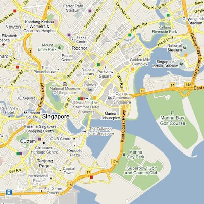
Singapore & Kallang Rivers BEFORE Marina Barrage:
Singapore & Kallang Rivers AFTER Marina Barrage:(THEN):
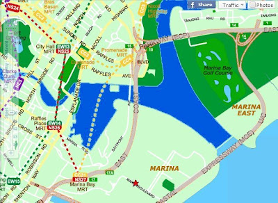

The fact we are familiar is that all the dams which constructed our reservoirs had flooded an area enlarging their original rivers into an artificial lake. But, ALL except for Marina Barrage! It is not designed to flood up Singapore River & Kallang River to make any artificial lake to be used as any Reservoir. That is unique!
So where is the flood area caused by construction of Marina Barrage?
We don't need to have PHD in hydrological science in order to relate the obvious facts compared before and after the completion of Marina Barrage. Orchard Road did not flooded for 2 to 3 decades before, and only after the billion dollar Barrage.
But here is the most audacious lie about Marina Barrage & flood by famiLEE LEEgime:
http://www.todayonline.com/Singapore/EDC100712-0000063/Marina-Barrage-helped-prevent-a-bigger-disaster">Marina Barrage helped prevent a bigger disaster
by Ng Jing Yng
05:55 AM Jul 12, 2010
<script type="text/javascript"> var fontIndex = 2; var fontSize = new Array('0.63em', '0.69em', '0.75em', '0.88em', '1em', '1.13em'); </script> The Marina Barrage reservoir did help in preventing a bigger disaster during the recent flash floods, said Dr Amy Khor, who was present at yesterday's event in Bukit Gombak.
The Senior Parliamentary Secretary, Ministry of Environment and Water Resources, said that six out of the seven gates at the barrage were left open to manage the amount of rainfall during the heavy thunderstorms last month.
Dr Khor, also Member of Parliament for Hong Kah GRC, added that since the 1970s, the number of flood-prone areas had been reduced from 3,200 hectares to 66 hectares.
The Government has spent at least $2 billion to improve the drainage system and will continue to review the current system, she said.
As for the impact of climate change on rainfall patterns, Dr Khor said that the Government had undertaken a vulnerability study but rainfall patterns were difficult to predict and there was a need to wait for new inputs on improving forecasting methods. Ng Jing Yng posted by uncleyap at http://uncleyap.blogspot.com/2010/07/flood-hydrological-basic-simple-enough.html" title="permanent link">8:54 AM
<!-- End .post -->
<!-- Begin .post -->
FLOOD: hydrological basic simple enough for everyone
Construction of Dam on river & filling up the flood area (before & after):
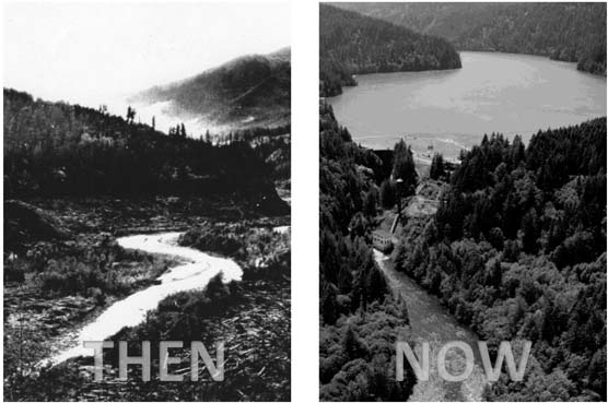
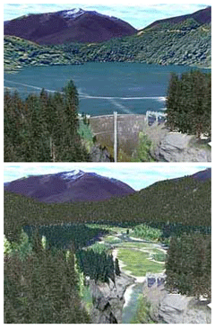
Before (bottom) and After (top) construction of Dam:
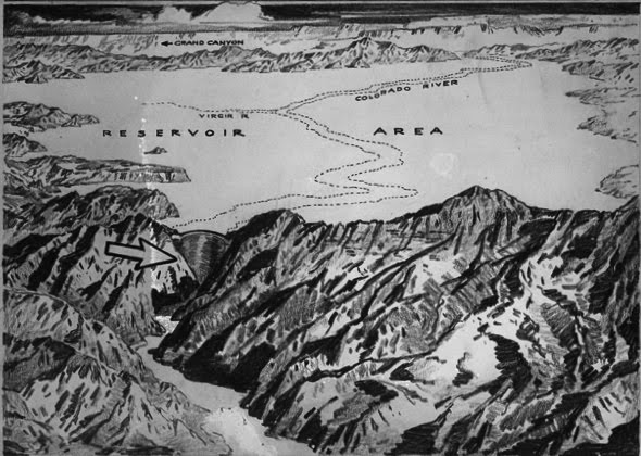
Hanson Dam example:
(Original Colorado River in dotted line)
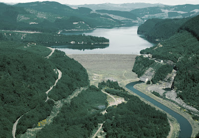
Another example Dam made Reservoir after flooding valley of tiny river:
Deeper water (in darker blue) indicated original river Shallower water (light blue) indicated additional area after flooded by dam:
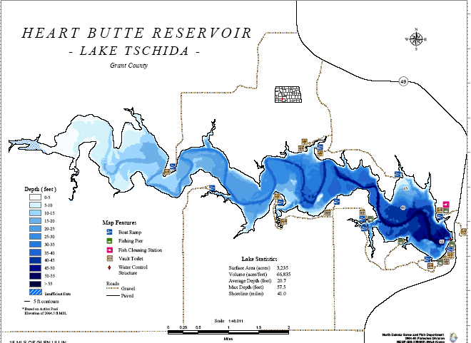
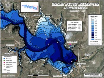
Dam Project Maps comparing original river & flooding river valley into reservoir:
By simple hydrological knowledge, we know that dams are constructed on rivers to flood their valleys into artificial lakes used usually as reservoirs. In Singaporean examples, McRitchie; Seletar (upper & lower); Kranji; Pandan; Peirce (upper & lower) are all reservoirs constructed out of their respective named rivers. I can only recall one reservoir - Bedok that is not constructed by building a dam on a river.
Before (bottom) and After (top) construction of Dam:

Hanson Dam example:
(Original Colorado River in dotted line)

Another example Dam made Reservoir after flooding valley of tiny river:

Deeper water (in darker blue) indicated original river Shallower water (light blue) indicated additional area after flooded by dam:


Dam Project Maps comparing original river & flooding river valley into reservoir:

The famiLEE LEEgime now built Marina Barrage, to dam both Singapore River & Kallang River, to become yet another fresh water reservoir. That is another expensive plan of PUB under MEWR under Yaacob Ibrahim to have have water after failure to negotiate water supply from Malaysia.
Singapore & Kallang Rivers BEFORE Marina Barrage:

Singapore & Kallang Rivers AFTER Marina Barrage:(THEN):


Orchard Road BEFORE Marina Barrage (THEN):


<img src="http://www.fgautron.com/gallery/albums/singaporemar2005/DSC00484.jpg" width="700px">
Orchard Road AFTER Marina Barrage (NOW):
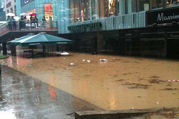
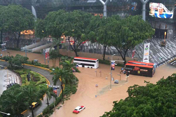
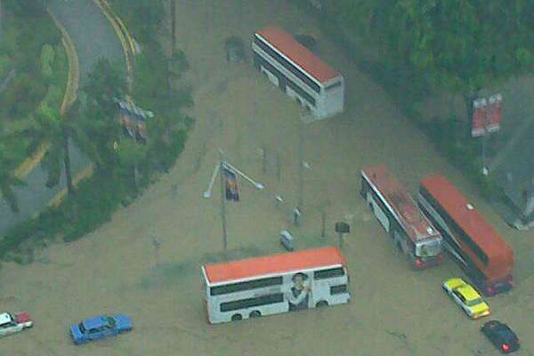


<img src="http://www.fgautron.com/gallery/albums/singaporemar2005/DSC00484.jpg" width="700px">
Orchard Road AFTER Marina Barrage (NOW):


The fact we are familiar is that all the dams which constructed our reservoirs had flooded an area enlarging their original rivers into an artificial lake. But, ALL except for Marina Barrage! It is not designed to flood up Singapore River & Kallang River to make any artificial lake to be used as any Reservoir. That is unique!
So where is the flood area caused by construction of Marina Barrage?
- Orchard Road became Orchard Reservoir?
- Bukit Timah Road became Bukit Timah Reservoir?
- Several others in the catchment areas of Singapore & Kallang Rivers?
We don't need to have PHD in hydrological science in order to relate the obvious facts compared before and after the completion of Marina Barrage. Orchard Road did not flooded for 2 to 3 decades before, and only after the billion dollar Barrage.
But here is the most audacious lie about Marina Barrage & flood by famiLEE LEEgime:
http://www.todayonline.com/Singapore/EDC100712-0000063/Marina-Barrage-helped-prevent-a-bigger-disaster">Marina Barrage helped prevent a bigger disaster
by Ng Jing Yng
05:55 AM Jul 12, 2010
<script type="text/javascript"> var fontIndex = 2; var fontSize = new Array('0.63em', '0.69em', '0.75em', '0.88em', '1em', '1.13em'); </script> The Marina Barrage reservoir did help in preventing a bigger disaster during the recent flash floods, said Dr Amy Khor, who was present at yesterday's event in Bukit Gombak.
The Senior Parliamentary Secretary, Ministry of Environment and Water Resources, said that six out of the seven gates at the barrage were left open to manage the amount of rainfall during the heavy thunderstorms last month.
Dr Khor, also Member of Parliament for Hong Kah GRC, added that since the 1970s, the number of flood-prone areas had been reduced from 3,200 hectares to 66 hectares.
The Government has spent at least $2 billion to improve the drainage system and will continue to review the current system, she said.
As for the impact of climate change on rainfall patterns, Dr Khor said that the Government had undertaken a vulnerability study but rainfall patterns were difficult to predict and there was a need to wait for new inputs on improving forecasting methods. Ng Jing Yng
<!-- End .post -->
Last edited:


